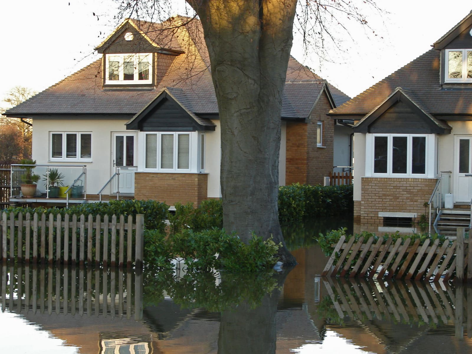
Flooding is one of the few things that can materially change what a home costs to own — insurance premiums, mortgage terms, even resale value — and it is completely invisible on a sunny viewing day. The good news: England and Wales have some of the best public flood data anywhere, and checking it takes minutes.
This guide covers the different kinds of flood risk, where the official data comes from, what the risk bands actually mean in practice, and what to ask when a result comes back higher than you would like.
The three kinds of flood risk
When people picture flooding they usually picture a river bursting its banks. That is only one of three distinct risks, and they behave very differently.
- Rivers and the sea — the classic risk. Driven by prolonged rain or tidal surge, usually well mapped, and often reduced by flood defences. If a home is near a watercourse or the coast, this is the number to check first.
- Surface water — flash flooding from short, intense storms that overwhelm drains before water ever reaches a river. It can happen on a hill, miles from any watercourse, and it is the risk buyers most often miss.
- Groundwater and reservoirs — rarer, but real in some areas: water tables rising through floors in chalk country, or the (very low-probability) failure of a reservoir upstream. The official check covers both.
Where the official data comes from
For England, the Environment Agency publishes a free check your long-term flood risk service on GOV.UK that gives river/sea and surface-water risk for any postcode, based on its National Flood Risk Assessment. For Wales, the equivalent is Natural Resources Wales’ flood-risk map. Both are the same sources insurers and conveyancers reference.
One thing to be careful about: the Environment Agency also publishes a separate "Flood Map for Planning" showing Flood Zones 1–3. That map exists for planning applications and deliberately ignores flood defences, so a well-defended street can sit in Flood Zone 3 while its actual long-term risk is rated low. For buying decisions, the long-term risk service — which does account for defences — is the one to read.
Sources: GOV.UK — Check your long-term flood risk · Natural Resources Wales — flood risk maps · Environment Agency
What the risk bands actually mean
The long-term risk service reports each risk on a four-step scale. The bands are annual probabilities, and small-sounding percentages add up over the life of a mortgage:
- High — more than 1 in 30 (3.3%) chance in any given year.
- Medium — between 1 in 100 (1%) and 1 in 30 (3.3%) each year.
- Low — between 1 in 1,000 (0.1%) and 1 in 100 (1%) each year.
- Very low — less than 1 in 1,000 (0.1%) each year.
- For scale: a steady 1-in-100 annual chance compounds to roughly a 1-in-5 chance of at least one flood over a 25-year mortgage term.
What it means for insurance and your mortgage
A medium or high rating rarely makes a home unbuyable, but it changes the sums. Insurers price flood risk street by street, so quotes in higher-risk areas can carry noticeably higher premiums and flood excesses — get an actual buildings-insurance quote for the specific address before you commit, not after.
Flood Re, a joint government–industry reinsurance scheme, keeps cover affordable for most higher-risk homes, but with a hard exclusion worth knowing: homes built on or after 1 January 2009 are not eligible, which is precisely why insurance on some newer riverside developments is expensive. The scheme is currently due to run until 2039.
Mortgage lenders, for their part, rely on the valuer’s report. A high-risk result can prompt a lender to ask for evidence that insurance is obtainable at reasonable cost; it is unusual for mainstream lenders to decline solely on flood risk, but it happens with the highest-risk properties. Your conveyancer’s environmental search will flag the same data, so it is far better to know before you are emotionally and financially committed.
Sources: Flood Re — how the scheme works · MoneyHelper — home insurance
Worked example: what flood risk does to the sums
Put numbers on it. Take two similar £280,000 terraced houses. House A rates "very low" on every flood layer; a typical buildings-and-contents quote might come in around £300 a year with a £250 excess. House B, two streets closer to the river, rates "medium" for river flooding: quotes come back at £550–£900 a year, with a separate flood excess of £1,000–£2,500. (Illustrative figures — flood pricing is street-by-street, which is exactly why you get real quotes for the exact address.)
Over a 25-year mortgage, a £400-a-year premium gap is £10,000 before any claim ever happens — and unlike a dated bathroom, it never stops costing. Add the flood excess you would pay in an actual event, the disruption (a serious flood typically means months out of the home while it dries), and the fact that the next buyer will run the same checks you did, and a medium rating is clearly worth something off the price.
The arithmetic is not an argument to walk away — it is an argument to price accurately. £10,000–£15,000 of lifetime cost difference is a legitimate, evidence-based input to your offer on House B, not a rude one.
What a flood result means for your offer
A medium or high result is negotiating information, and the way to use it is to convert risk into pounds rather than adjectives. "I’m worried about flooding" moves nobody; "insurance on this address quotes £600 a year more than the equivalent on Elm Road, which is £15,000 over my mortgage term" is a number an agent has to carry back to the seller.
Work the other side of the ledger too: resilience measures have real value. A home that has flooded but now has flood doors, non-return valves on the drains, raised electrics and a documented Flood Re claim history is a fundamentally different proposition from the same house with none of that — some insurers reflect installed measures in pricing, and a property flood resilience survey report is evidence you can hand to them.
- Get two or three real insurance quotes for the exact address before offering — they are free, and they turn a map colour into a number.
- Ask the seller for their current premium, flood excess and claims history in writing via the agent.
- If the home has flooded, ask for the repair invoices and any resilience-survey report — documented recovery beats vague reassurance.
- Reflect the lifetime insurance gap, not just this year’s premium, in your offer arithmetic.
- If the result is high and the home was built after 1 January 2009, be extra careful: no Flood Re backstop means pricing can be severe. Take the insurance question to a specialist broker before exchange.
Where the risk concentrates: a regional sketch
River and tidal risk follows geography you can name: the tidal Thames and its tributaries, the Severn towns (Shrewsbury, Worcester, Bewdley), York and the Ouse, the Calder and Aire valleys in West Yorkshire, the Somerset Levels, low-lying Lincolnshire and the Fens, and coastal strips from the Humber to the Solent. Hull is the textbook case of a city where much of the housing stock sits below high-tide level behind defences.
Surface-water risk is different: it is urban, local and everywhere. Basement flats in London, homes at the foot of the South Wales valleys, and any street at the bottom of a hill with Victorian drainage can flag amber while the river map shows nothing. This is why you check the address, not the town — two houses fifty metres apart routinely carry different ratings, and the difference is exactly the kind of thing a viewing never shows you.
Surface water: the one buyers miss
Surface-water flooding now affects more properties in England than river and sea flooding, and it behaves counter-intuitively. It follows the shape of the land, not the location of rivers, so a house at the bottom of a gentle dip, a basement flat, or a home where the garden slopes towards the back door can flood in a summer cloudburst while the flood map for rivers shows nothing at all.
On viewings, look for the physical tells: driveways that fall towards the house, airbricks close to ground level, watermarks on garden walls, and drains at the low point of the road. If you can, drive past during heavy rain — it is the cheapest flood survey you will ever commission.
Questions to ask before you offer
If the data shows anything above low risk, ask direct questions — sellers must answer the standard TA6 property information form honestly, and that form asks explicitly about flooding.
- Has the property ever flooded, and if so when, how deep, and from what source?
- Have the current owners ever made an insurance claim for flood or storm water damage?
- What do the current owners pay for buildings insurance, and what is their flood excess?
- Are there local defences, and who maintains them? (Your solicitor can check.)
- Any flood-resilience measures fitted — flood doors, non-return valves, raised electrics?