What is under a house matters as much as what is in it — and unlike a dated kitchen, ground problems are expensive precisely because they are invisible at a viewing. The three that matter most in England and Wales: radon gas, subsidence, and legacy mining.
All three are mapped by official bodies — the UK Health Security Agency, the British Geological Survey and the Mining Remediation Authority — and all three are screening checks: a flag means "investigate", almost never "walk away". This guide explains each risk, how to check it, and what the follow-up investigations cost.
Radon: the invisible one
Radon is a naturally occurring radioactive gas produced by uranium decaying in rocks and soils. Outdoors it disperses harmlessly; inside a building it can accumulate, and long-term exposure at high levels is the UK’s second-largest cause of lung cancer after smoking. It has no smell, taste or colour — the only way to know a home’s level is to measure it.
The UK Health Security Agency (UKHSA) and the British Geological Survey publish the definitive map at ukradon.org. Areas where at least 1% of homes are expected to exceed the "action level" of 200 becquerels per cubic metre are designated radon Affected Areas — concentrated in the South West, parts of Wales, the Pennines and other granite and limestone country, though pockets exist elsewhere. UKHSA also recommends acting above a lower "target level" of 100 Bq/m³.
Checking is cheap and layered: the free map gives the area picture; an address-specific radon risk report from UKHSA costs a few pounds; and the definitive answer — an actual measurement — is a three-month test with two small detectors, around £50–£60. If a result comes back high, remediation (typically a radon sump with a small fan, or positive ventilation) usually runs from several hundred pounds to a couple of thousand, and works. Sellers who have tested must disclose results if asked via the TA6 form — so ask.
Sources: UKradon — official UK radon maps and reports · UK Health Security Agency
Subsidence and shrink-swell clay
Subsidence is the ground under a building giving way, and its most common driver in England is shrink-swell: clay soils that expand when wet and shrink in drought, flexing whatever sits on them. The British Geological Survey’s GeoSure dataset maps this susceptibility nationally, and the geography is stark — the clays of London and the South East are the UK’s subsidence heartland, and dry summers reliably produce spikes in claims.
Risk factors stack: shrinkable clay, plus large thirsty trees (oaks, willows, poplars) close to the house, plus the shallow foundations typical of Victorian and Edwardian stock. On viewings look for diagonal cracks wider than about 3mm running from the corners of doors and windows, doors that stick seasonally, and visible gaps between walls and floors — hairline cracks in plaster, by contrast, are usually just a building living its life.
Two money facts. Buildings insurance normally covers subsidence, but typically with a £1,000 excess, and a property with a subsidence history must be declared to insurers indefinitely — which raises premiums and narrows your choice of insurer, permanently affecting resale. And if a survey raises movement, the next step is a structural engineer’s inspection (commonly a few hundred pounds, more with monitoring over time) — cheap against the cost of getting it wrong. Historic, stabilised, well-documented movement can be perfectly liveable; what you cannot price is undocumented movement.
Sources: British Geological Survey — GeoSure and ground stability
Worked example: pricing a subsidence history into an offer
Say you like a 1930s semi asking £330,000 on London clay, and the paperwork discloses movement in 2016, repaired with partial underpinning under an insurance claim. First, the documents to demand (via your solicitor): the structural engineer’s report and completion certificate for the repair, the insurance claim record, and confirmation of whether the current insurer offers continuation of cover to a new owner — that last one is the hinge, because inheriting an existing insurer at sane terms removes most of the pain.
Then the arithmetic. If fresh quotes for a declared-subsidence house come back at, say, £850 a year against £350 for the unblemished house next door, that £500 gap is £12,500 over a 25-year term. Add the drag at resale — some future buyers will simply walk at the word "underpinned", thinning your exit market — and comparable sold evidence for repaired-subsidence homes typically lands some percentage below clean equivalents; the discount you pay at should at least cover the lifetime insurance gap plus something for the thinner resale. If the sellers cannot produce the engineer’s certificates at all, the discount conversation becomes a walk-away conversation: undocumented movement is the one version of this risk you cannot price.
Two professionals decide this one, not a website: a structural engineer (or Level 3 surveyor) on whether the movement is genuinely historic, and your solicitor on whether the paper trail and insurance position hold up. Their combined fees are a few hundred pounds against a five-figure decision.
Coal mining and the CON29M search
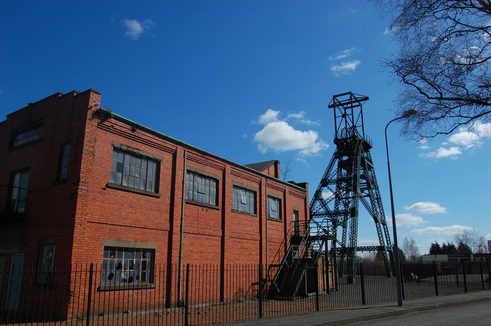
Britain’s coalfields run under large parts of the Midlands, the North, South Wales and beyond — millions of homes sit above them. The risks are legacy ones: old shallow workings that can collapse, unrecorded mine entries (shafts and adits, sometimes in back gardens), and ground movement from historical extraction.
The Mining Remediation Authority (until 2024 named the Coal Authority) holds the national database. A free postcode check at gov.uk/check-coal-mining-subsidence tells you whether a property sits in a coalfield area; if it does, your conveyancer will order a CON29M coal mining search — the standard report covering recorded workings, mine entries, subsidence claims and treated hazards, typically costing in the low tens of pounds to around £100 depending on the product. In coalfield areas lenders effectively require it, and your solicitor will order it as a matter of course.
If the search shows recorded mine entries near the property or shallow workings beneath it, follow-ups include an interpretive mining report or, rarely, intrusive site investigation. Note also that the Mining Remediation Authority runs a claims process for coal-mining subsidence damage — a past claim on the property is disclosable history your solicitor should chase.
Sources: GOV.UK — check coal mining subsidence · Mining Remediation Authority
Beyond coal: the other holes in the map
Coal is not the only thing Britain mined. Depending on region, your solicitor may recommend non-coal mining or ground-stability searches:
None of this should alarm anyone by itself — it is routine regional conveyancing. The pattern to respect: local solicitors know which searches their patch needs, which is a quiet argument for using one.
- Tin and other metal mining — Cornwall and west Devon, where historic workings honeycomb some areas.
- Brine and salt extraction — Cheshire, with its own compensation-district search.
- Chalk and flint workings — pockets of Kent, Surrey, Essex and Norfolk, including centuries-old deneholes.
- Limestone, slate, lead and clay extraction — various regions; plus natural dissolution ("sinkhole") susceptibility in some chalk, gypsum and limestone country, mapped by BGS.
Regional cheat sheet: what to check where
No area carries every risk. A rough map of which check earns its keep where — treat it as a prompt, not a substitute for the searches your local solicitor recommends:
- South West (Cornwall, Devon, Somerset granite country) — radon first, plus tin/metal mining searches in Cornwall and west Devon.
- London and the South East — shrink-swell clay subsidence, especially streets with mature oaks, willows and poplars over Victorian foundations; radon pockets in the Chilterns and North Downs chalk.
- The Midlands, South Wales, Yorkshire, the North East — coal: the free postcode check, then CON29M; radon in the Pennines and parts of Wales.
- Cheshire — brine and salt extraction, with its own compensation-district search.
- East Anglia, Kent, the chalk belt — historic chalk workings and deneholes; low subsidence risk outside clay pockets; generally quiet on radon.
- Peak District, Derbyshire, Yorkshire Dales — radon (limestone country) plus lead-mining legacy in places.
What checking actually costs
Rough 2026/27 figures for the full ladder, from free screening to professional investigation:
- Free — UKHSA/BGS radon map, GOV.UK coal-mining postcode check, BGS GeoIndex geology viewer, and the ground/radon/mining summary in a Housometer report.
- A few pounds — address-specific UKHSA radon risk report.
- Around £50–£60 — a validated three-month home radon measurement.
- Tens of pounds to ~£100 — CON29M coal search or regional equivalents, ordered by your solicitor within conveyancing.
- Low hundreds — combined environmental/ground-stability search reports bundled by conveyancers.
- Several hundred pounds and up — structural engineer’s report on suspected movement; four figures for intrusive ground investigation (rare, and usually a seller-price conversation by then).
Questions for the seller and your solicitor
Most ground-risk pain is avoidable with questions asked early enough to matter. Put the first set to the agent in writing; hand the second set to your solicitor with the memorandum of sale.
- To the seller: has the property ever been tested for radon, and what was the result? (TA6 answers must be honest.)
- To the seller: any history of movement, cracking, monitoring or repairs — and the engineer’s reports and guarantees for any works?
- To the seller: any past insurance claims for subsidence, heave or ground movement, and what do they currently pay for buildings cover?
- To your solicitor: which mining or ground-stability searches does this area need beyond the standard environmental search?
- To your solicitor: does the title or search history show any past coal-subsidence claim, remediation or mine entry within influencing distance?
- To your surveyor: given the age and location, would you recommend a Level 3 survey or a structural engineer before exchange?
If a risk shows up: the sane response
A flag on a screening map is a probability statement about an area, not a verdict on a house. The sane sequence is: screen (free), then measure or search (cheap), then investigate professionally (only if the previous step says so) — escalating only when the evidence does.
Radon above the action level is fixable for the cost of a boiler service habit; well-documented historic subsidence with an engineer’s sign-off can be a negotiating lever rather than a dealbreaker; a coalfield address with a clean CON29M is simply normal in half the North. What should genuinely give pause: sellers evasive about known history, undocumented repairs to cracking, or an insurer declining cover. Those are matters for your solicitor and a RICS surveyor — and this guide, as ever, is guidance rather than professional advice.